
NASA/NOAA GOES Project
Hurricane Irene Makes Landfall in North Carolina
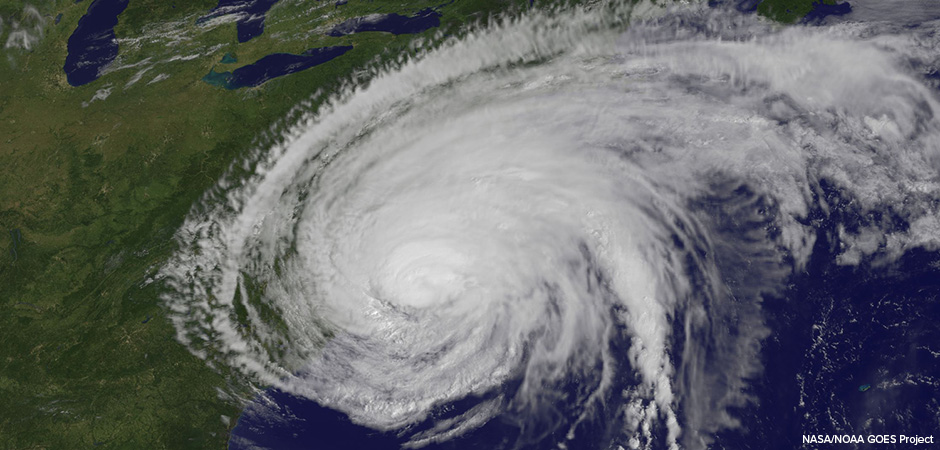
The GOES-13 satellite saw Hurricane Irene on August 27, 2011 at 10:10 a.m. EDT after it made landfall at 8 a.m. in Cape Lookout, North Carolina. Irene’s outer bands had already extended into New England. From 22,300 miles in space, Hurricane Irene looks serene and impressive. That’s how NOAA’s GOES satellite sees Irene today as it batters the eastern U.S. coastline, but it’s quite a different story on the ground. Irene made landfall in Cape Lookout, North Carolina at 8 a.m. EDT as a Category one hurricane with maximum sustained winds near 85 mph. The storm surge and rough waves it brought have been severely battering the coast. The GOES-13 satellite saw Hurricane Irene after landfall at 8 a.m. in Cape Lookout, North Carolina on August 25, 2011 at 10:10 a.m. EDT. At that time Irene’s outer bands had already extended into New England.