

Historians and archaeologists have held many debates about the purpose of hundreds of Roman forts throughout what today is Iraq, Syria, and Jordan. Many scientists thought Romans built the forts during the 2nd and 3rd centuries to protect the Roman empire’s eastern border from attack. However, researchers recently used Cold War era satellite images to challenge that idea. Instead, they think the forts were part of a trade and communication network.
Antoine Poidebard
Antoine Poidebard was one of the first to identify these Roman forts in the Middle East. He was a priest and a trained pilot. During World War I, he served as a chaplain and a pilot in the French Armed Forces. During the 1920s, he used his piloting skills to begin aerial archaeological surveys of the desert in what is today Iraq, Syria, and Jordan. An aerial archaeological survey is a search for buildings and other historical sites using photographs taken from airplanes. Poidebard was the first person to use aerial photographs to identify archaeological sites.
Poidebard flew over a known route, a road built by Roman Emperor Diocletian, who ruled the empire from 284-305 C.E. Poidebard mapped 116 forts along the route. The route began at the Jordanian border, moved north through Syria, and ran southeast along the Euphrates River until it met the Khabur River. Poidebard then moved north again to Nisibis on the modern-day Turkish border and ended at the Tigris River in Iraq.
Poidebard took pictures of each structure from the air and examined some of the forts in person. A few sites were excavated, or uncovered, to study in more detail. Based on what he found, Poidebard decided the Romans built the forts during the 2nd and 3rd centuries. He proposed the theory that the forts defended the Roman Empire’s eastern border because they formed a line running north to south. After Poidebard completed his work in the 1930s, archaeologists only investigated a few forts in the area. Scientists only recently began looking for more forts in the region.
The Corona and Hexagon Satellite Programs
During the Cold War, political tensions between the United States and the Soviet Union were very high. Two different satellite programs during these decades used high-powered cameras to capture images from the Soviet Union, China, the Middle East, and Southeast Asia. The Corona satellite program operated between 1959 and 1972. The more advanced Hexagon satellites were used between 1971 and 1986. In the 2010s, researchers in the Anthropology Department of Dartmouth College began using archived satellite images from the Corona and Hexagon satellites to look for archaeological sites.
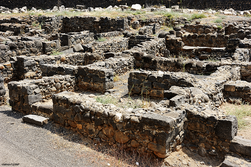
Finding Forts
Archaeologists wanted to use the satellites to look for evidence of Roman forts. They wanted to use satellite images because the region’s landscape had changed so much since the pictures were taken due to farming, construction, and war. Researchers knew Roman forts were usually square, with walls from 164 to 262 feet long. The researchers began to search the images for square structures with those measurements. At first, the researchers looked along the same route Poidebard covered in the 1920s. But Poidebard’s map identified the location of forts by landmarks, and it was difficult to match up to the changing landscape. As researchers looked at more images, they realized there were more forts over an even larger area. Poidebard’s original 116 forts were only a small amount of what was in the region. The researchers identified 396 fortified structures. The forts were from the Tigris River in Iraq, through Syria and Jordan, and west toward the Mediterranean Sea.
New Information
Based on newer excavations of sites in the region, researchers think Romans built the forts between the 2nd and the 6th centuries. Researchers also disagreed with Poidebard’s theory that the forts were for defense. Since researchers found so many forts across the region, they think Romans constructed the sites to increase trade and communication.
The forts provided a place for travelers and traders to sleep and eat. They also provided safety for people and goods while traveling through the region. The convenience and protection provided by the forts allowed trade and communication to happen across greater distances. The researchers point out that more historical images of the region could become available. These images could lead to the discovery of new sites and provide more understanding of the region’s ancient history.