
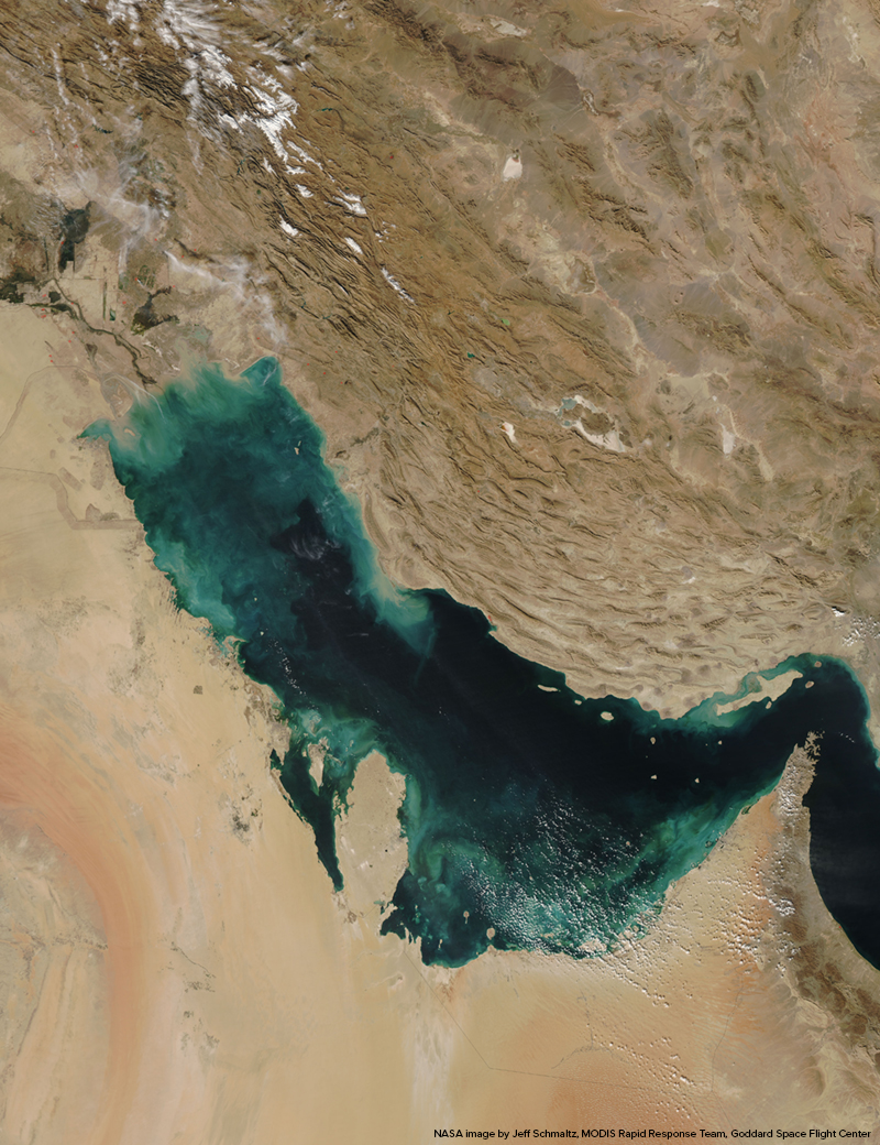
Clouds of tan, blue, and green swirl fancifully along the shores of the Persian Gulf in this photo-like image, captured by the Moderate Resolution Imaging Spectroradiometer (MODIS) on NASA’s Aqua satellite on November 28, 2007. Near the shore, the color is almost certainly sediment washing into the gulf, turning the water tan and then green and finally blue as it disperses. Some of the color may also be sediment churned up from the gulf’s shallow bed in the north near Iraq and along its southwestern shore. The gulf is deeper on the east near the Iranian shore, where the water is clear and black. Much of the dirt clouding the water in this image is coming from the Shatt al Arab River, which enters the Gulf in the north along the Iran-Iraq border. The river drains the combined waters of the Euphrates and Tigris Rivers of Iraq and the Karun River of Iran. Though other rivers empty into the Persian Gulf, most of the fresh water that enters the gulf comes from the Shatt al Arab. On the right edge of the image is the narrow Strait of Hormuz, which connects the Persian Gulf to the Arabian Sea, part of the northern Indian Ocean.
Persian Gulf and Strait of Hormuz
Persian Gulf and Strait of Hormuz